NOAA and NCAR team up to support wildfire research
Strong winds, dry terrain, and high temperatures made the 2020 Western U.S. fire season one of the worst in recorded history. Fifty-six thousand wildfires burned over 10 million acres of land, three million more than the current 10-year average.
The image below shows the simulated volume and dispersal of smoke during the last days of August 2020. The simulation data were computed with NOAA's High-Resolution Rapid Refresh model and visualized with NCAR's VAPOR software.
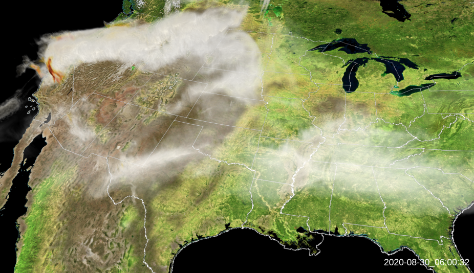
An image of volume renderings showing the simulated dispersal of wildfire smoke over the Western U.S. in late August 2020.
Simulation data provided by Ka Yee Wong and Ravan Ahmadov of NOAA’s Global Systems Laboratory. Visualization by Scott Pearse of NCAR’s Computational and Information Systems Laboratory. For more information regarding the data visualization image, and for a