Cheyenne simulations highlight increasing megaflood risk
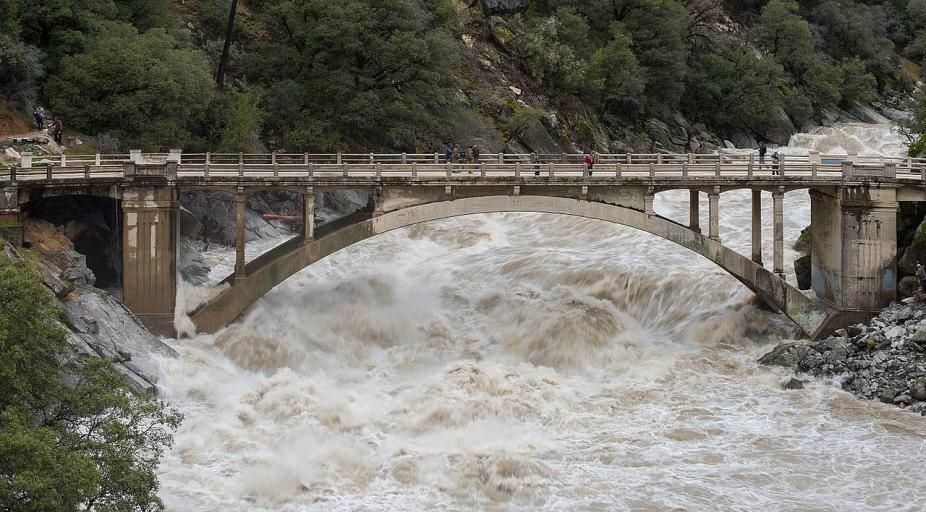
The South Yuba River at Highway 49 during 2017 floods that would ultimately cause 5 deaths and more than $1.5 billion in damage. A historic megaflood, which may become more frequent with climate change, would be far more catastrophic. (Kelly M. Grow, California Department of Water Resources.)
A new study by National Center for Atmospheric Research (NCAR) scientists indicates the likelihood of a calamitous California flood has already doubled because of climate change. Such a megaflood could submerge large swaths of the state and displace millions of residents, as noted in this news item from the University Corporation for Atmospheric Research.
Using the Cheyenne supercomputer at the NCAR-Wyoming Supercomputing Center, the scientists coupled the Community Earth System Model and the Weather and Research Forecasting Model to simulate multi-week storms.
“The megaflood risk with climate change is much greater than we expected,” said NCAR scientist Xingying Huang, the co-lead author of the study. “These types of extreme events are rare, but they will happen, as predicted, with more frequency as warming continues.”
The last time such an event hit California, in 1861-62, the deluge of water transformed much of the state into an inland sea, killing 1% of the population and resulting in devastating economic losses. If society were to follow a worst-case climate scenario of emitting greenhouse gasses at a high rate, the state by later this century could expect to experience a catastrophic megaflood about every 30-35 years instead of just once in two centuries.
The study was published in Science Advances and was highlighted recently in this HPCwire article.